A Spectacular Day
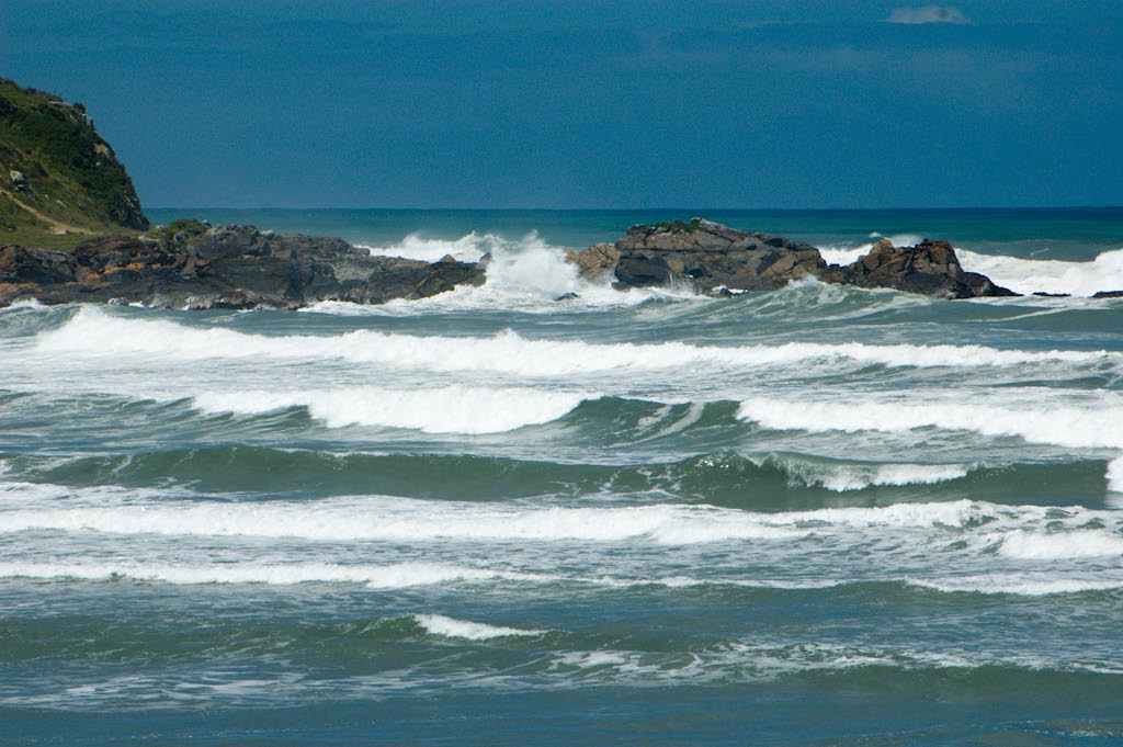
We began Monday, Nov. 22 at the northern end of the west coast of the south island. The guidebook describes Westport as one of the west coast's "most dispiriting towns" and is "a drab low-slung place of wide streets and slim opportunities." With this encouraging description, we weren't expecting a whole lot, but found ourselves thrilled with the nearby seal colony and beach near Cape Foulwind. No potty jokes -- Captain Cook named the cape after the terrible weather he encountered here. We didn't see many seals, but the coastline was rocky and gorgeous. Hart, our official photographer, took a great series of photos of a wave breaking against a rock. However, you would have to wait forever to see al the photos we want to show you from the past two days, so here's a nice shot of the surf at Cape Foulwind.
Our much needed visit to the petrol station was followed by lunch at Freckles (a cafe named after yours truly) and a gleeful hour of pouring photos onto Tacky Magnet. From there we drove north to Oparara Basin, near a town named Karamea, because I'd read about some limestone formations there. Two hours north and west of anything else on the island (including other roads), this part of the trip was a gamble on a guide book's promising description. I'm thrilled to say that the Rough Guide to New Zealand has upheld its status as exalted traveling companion.
It was late afternoon by the time we made it all the way north and across a long, bumpy dirt road. We didn't have much time before dark, so we took the path to the Oparara Arch, which was described as a 45-minute roundtrip. These times are never accurate for us: with picture-taking and stops to admire sites, we take the full time listed to go into the site, then we spend a long time at each site, then we hurry on the way back to get to the next spot.
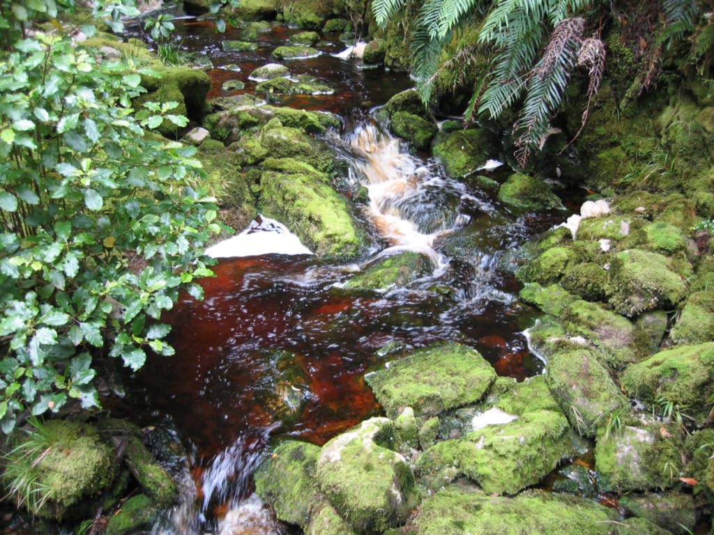
The first feature to capture our attention was the water. Throughout the Oparara River, the water runs a dark reddish-brown, ranging from a pale orange-red to black. In many spots, it looks like the water has been replaced with flat Coke or, less amusingly, lots and lots of blood. "Don't drink the water; there's blood in the water," Hart sang repeatedly, which is from Don't Drink the Water by the Dave Matthews Band. Interestingly, we have been discussing the themes in the song, which is about the struggle between Native Americans and white settlers, as we learn about the conflicts between the Maori and the white settlers of New Zealand. Sorry to digress to Dave Matthews Band references, but I know it will help illustrate our trip for some of you.
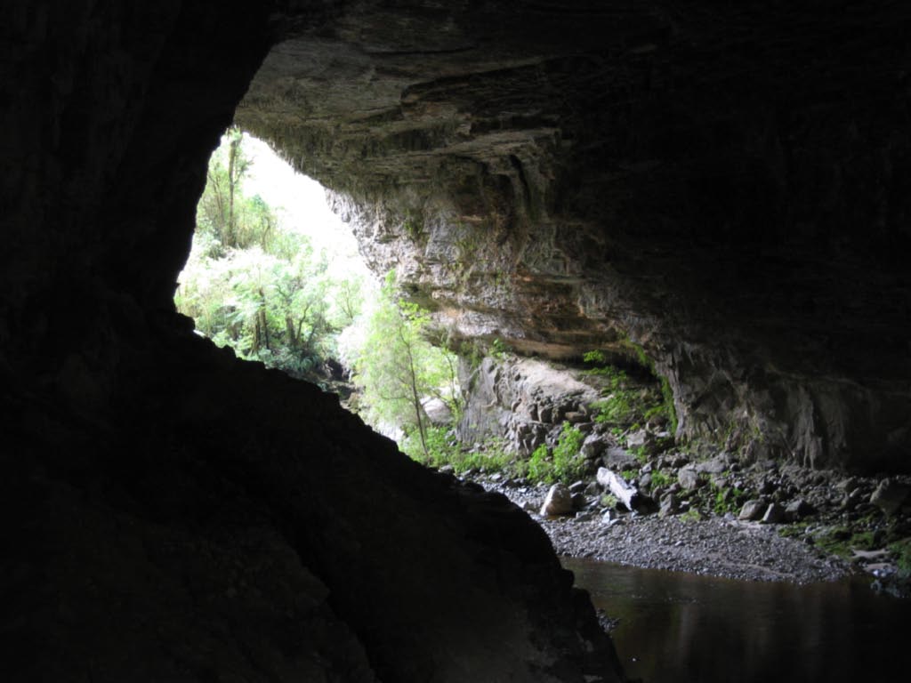
Back to the subject at hand: Described as elusive to photograph, the Oparara Arch is 200 meters long, 49 meters wide and 37 meters tall. Hart took a good picture from inside it, but it doesn't come close to showing how massive the arch is.
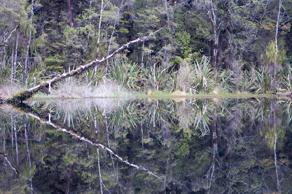
Returning to the car park and running short on time, we took a short walk to the Mirror Tarn. Even though we didn't know what it was, it was the only other walk we had time for. Another tremendous sight, the "mirror" was black water in a pond that reflected the trees and bushes surrounding it. Take a close look at the photo below: it is of the pond taken at an angle and not including any of the sky.
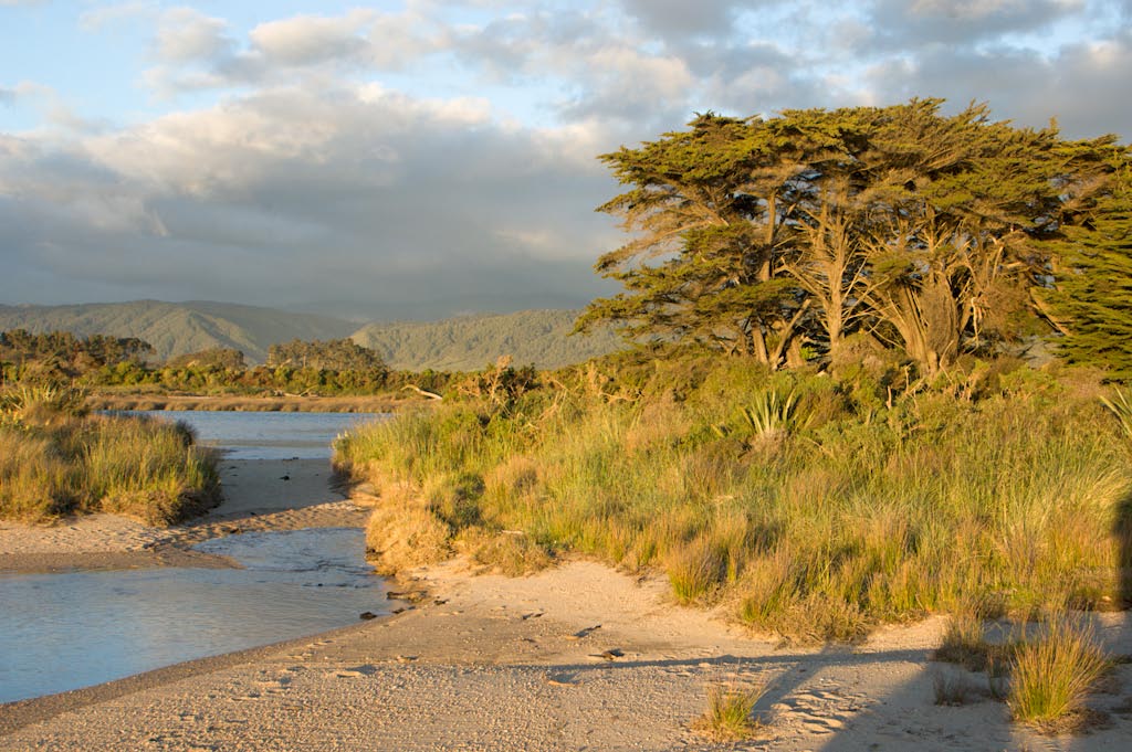
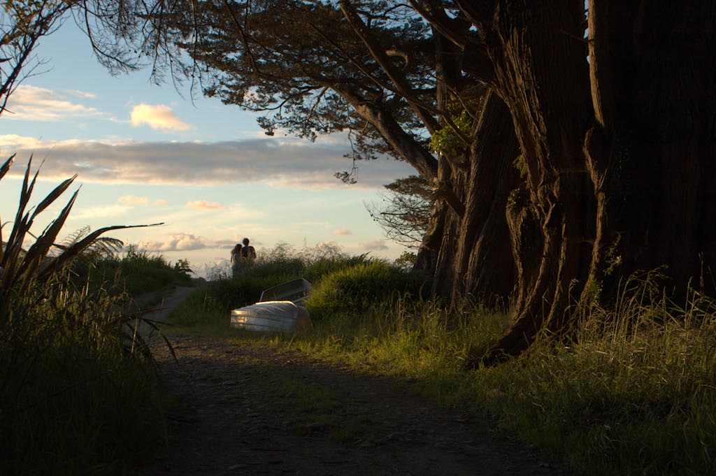
Knowing we would be coming back on Tuesday and that we had to drive a ways to find a holiday park, we saved the rest for later. At the holiday park, our spot was one of only three occupied sites. It was the least populated place we've stayed and was one of the most attractive, with an estuary running behind it. We went out there close to high tide and watched the water lap up. The setting was simple and had no outstanding features to mention, but it was peaceful and beautiful. Again, Hart got some great pictures, including one of me scowling at the water as it threatened to soak my feet and a sunset shot of some mysterious couple.
posted by Kerrie @ 11/23/2004 01:19:00 PM
0 Comments
![]()
0 Comments:
Post a Comment
Subscribe to Post Comments [Atom]
<< Home